Show how the land opens up
Land and Ranch Drone Photography in Bastrop, TX
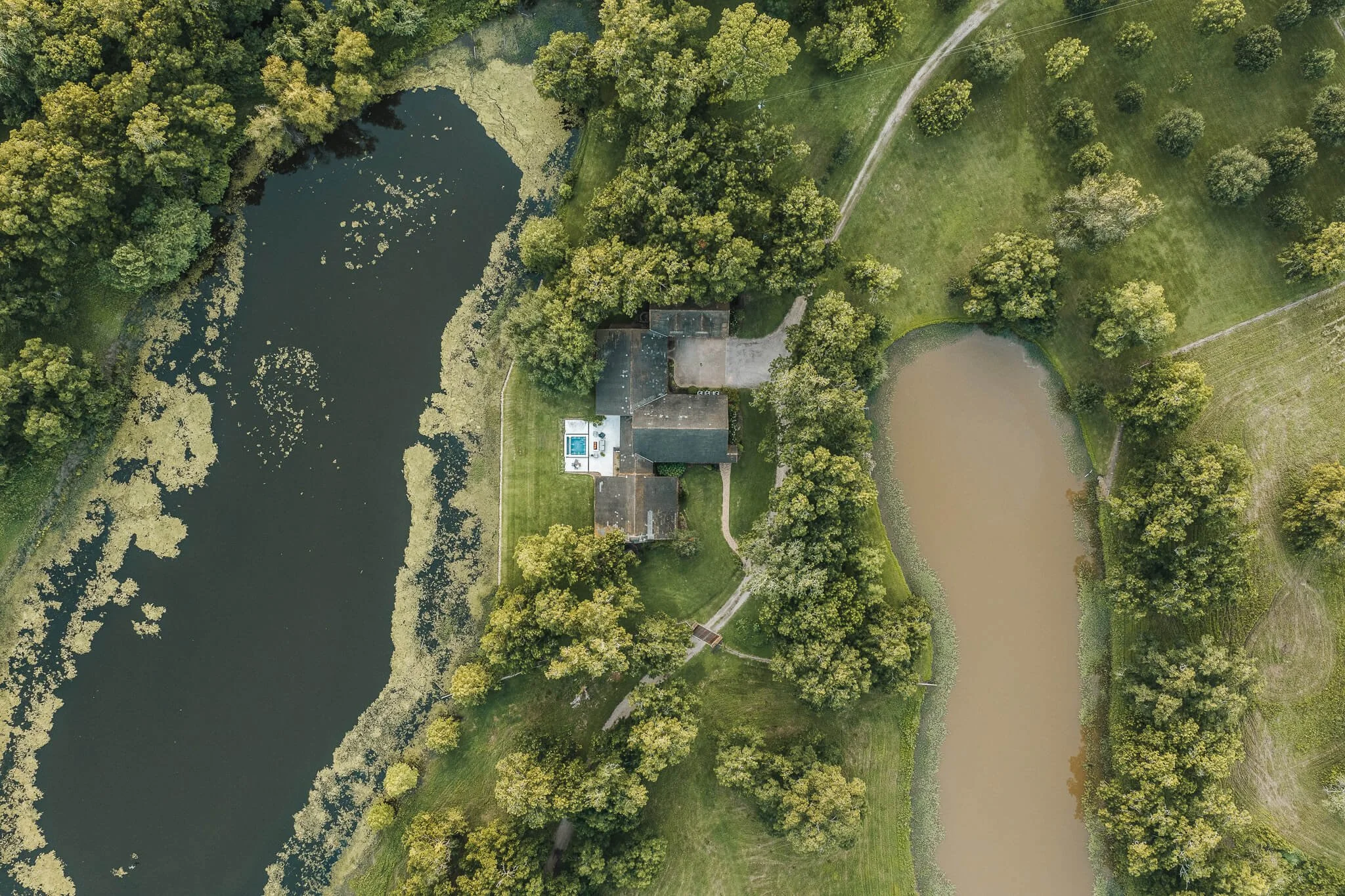
For land and ranch drone photography, Bastrop, TX sellers need a view that respects real acreage. Skycrafted Imaging documents wooded and pastured ground, river-adjacent tracts, and rural holdings with aerial perspective, ground photography, and measured motion.


A roadside image cannot explain a working landscape
Bastrop County has genuine rural ground at its edges. Properties may include Lost Pines forest, open pasture, a river approach, working improvements, or long internal distances. Those conditions are hard to understand from a few images near the entrance.
A flat gallery can leave a buyer guessing about usable space, tree cover, visible water, access routes, and how the tract holds together. That slows the first review and can make meaningful acreage feel smaller than it is.
You need more than attractive scenery. You need a visual introduction that helps prospects understand what deserves closer research and an in-person visit.
why skycrafted imaging
Map the property through useful viewpoints

Skycrafted Imaging plans coverage around the way a real tract is evaluated. We identify the approaches, open areas, wooded sections, visible improvements, and natural features that should be seen together.
Aerial stills establish scale and relationships. Ground images add texture at entry points and key locations. A concise reel can guide a viewer through the property's changing character without asking them to piece the experience together alone.
The result is honest orientation, not a substitute for a survey or due diligence. Your audience can decide whether the land fits their plans.
LAND AND RANCH DRONE PHOTOGRAPHY SERVICES IN BASTROP, TX
Choose the focused coverage that matches the assignment:

Choose coverage that supports the land's real character:
Wide tract overviews for pasture, tree cover, visible routes, and surrounding countryside.
Forest and field transitions for the changing terrain across Lost Pines acreage.
River-edge perspective for visible frontage, recreation areas, and access near the Colorado River.
Land story reels for offering pages, investor reviews, recreational buyers, and future-use discussions.
The property may be marketed for a future home, recreation, livestock, investment, or eventual development. Bastrop's large extraterritorial jurisdiction reaches well beyond city limits. We select frames that clarify the visible evidence for that specific conversation.
the process
A clear plan from address to delivery
Step 1. Book your shoot
Share the address, acreage, and listing date. We confirm the scope, talk through the property’s priorities, and schedule the right window.
Step 2. We craft the story
A Part 107 pilot arrives prepared to capture aerial and ground coverage in one visit. We work with the property, light, access, and marketing goal in mind.
Step 3. Deliver in 3–5 days
You receive a curated, MLS-ready gallery and reel, licensed for your marketing. Clean delivery. Clear next steps. Assets ready to publish.

WHAT THEY’RE SAYING


The Team Behind Every Frame
Aerial work grounded in the actual property
Skycrafted Imaging is Texas-based, licensed and insured, and serves 22 counties across Central and Southeast Texas. Land assignments in this area are served in Bastrop County.
Founder Lane Fritsch is FAA Part 107 certified. He combines professional aerial and ground equipment with a practical plan for terrain, entry, visible features, and the kind of story the marketing needs to tell.

ACERAGE NEEDS ORIENTATION BEFORE IT CAN EARN A VISIT
Land media cannot verify boundaries, water rights, access rights, or property condition. It can show visible relationships that prompt smarter questions. For Bastrop acreage, the connection between pine cover, open ground, river setting, and usable areas can be central to a buyer's first impression.
Success: You provide a legible introduction that helps qualified prospects prepare for a more informed land conversation.
Failure: The tract is reduced to scenic fragments, leaving its scale, features, and working character unclear.
Practical answers before you book
-
Yes. Skycrafted works with properties ranging from smaller tracts to expansive Texas ranches and large land holdings. We determine the right combination of ground and aerial media based on the size and features of the property.
-
Yes. Boundary overlays can be added to select aerial imagery when included in the project scope. Property boundary information should come from the client or an appropriate survey source.
-
Yes. Photography, cinematic video, and aerial media can be booked together to create a more complete visual package for a listing or presentation.
-
Typical delivery is approximately 3–5 business days, depending on the scope of the shoot and requested deliverables.
Let prospects understand the acreage before they drive out
Share the tract details and the story buyers need to see. We will create coverage that makes the land easier to assess from the first view.
Freebie alert
Unlock Our Exclusive Insights & Current Packages