Show the ground, access, and scale buyers need to see
Land and Ranch Drone Photography in Cedar Park, TX
For land and ranch drone photography, Cedar Park, TX assignments need an honest view of a changing edge. Skycrafted Imaging shows larger remaining parcels, assemblage opportunities, and transitional ground near a dense, established suburb.


THE BIGGER PICTURE MATTERS
Cedar Park is not ranch country. Most of the city is already developed. The remaining land often sits beside neighborhoods, roads, active uses, or future development conversations.
A ground-only gallery may hide those relationships. It can leave investors guessing about terrain, shape, access, adjacency, and the tract's position within the larger area. That uncertainty slows early review. You should not need to recreate a site map during every first call.
why skycrafted imaging
Aerial media built for investment-ground context
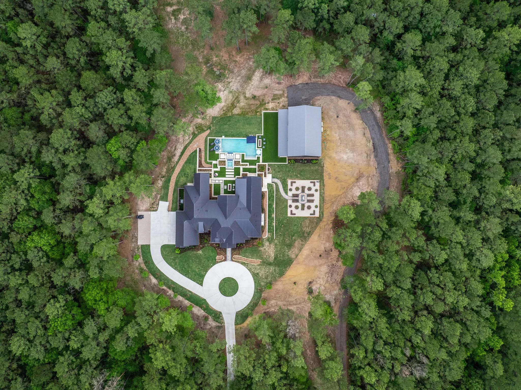
Skycrafted Imaging builds a visual route around the parcel's real questions. We use aerial stills, ground coverage, and cinematic motion to clarify how the site relates to its surroundings.
The aim is orientation, not a scenic-country narrative. Your material can help buyers and development teams study a property before deeper conversations begin.
We discuss access points and visible features first. That creates a sharper plan for a tract near an urban edge.
LAND AND RANCH DRONE PHOTOGRAPHY SERVICES IN CEDAR PARK, TX
Choose the focused coverage that matches the assignment:

Shape the assignment around the way this land may be evaluated:
High-altitude stills for tract shape, nearby development, routes, and setting.
Low aerial passes for terrain changes, tree cover, transitions, and approach.
Ground photography for entries, visible improvements, roads, and site conditions.
Short motion pieces for offering decks, investor reviews, and land-use presentations.
We can organize coverage around a remaining parcel, a possible assemblage, or a transitional property. The emphasis stays on useful context near Cedar Park's established fabric.
You receive material that supports a closer review. It should make the property's questions easier to ask.
the process
A clear plan from address to delivery
Step 1. Book your shoot
Share the address, acreage, and listing date. We confirm the scope, talk through the property’s priorities, and schedule the right window.
Step 2. We craft the story
A Part 107 pilot arrives prepared to capture aerial and ground coverage in one visit. We work with the property, light, access, and marketing goal in mind.
Step 3. Deliver in 3–5 days
You receive a curated, MLS-ready gallery and reel, licensed for your marketing. Clean delivery. Clear next steps. Assets ready to publish.

WHAT THEY’RE SAYING



The Team Behind Every Frame
Local perspective, professional execution
Skycrafted Imaging is Texas-based, licensed and insured, and serves 22 counties across Central and Southeast Texas. Cedar Park assignments are handled in Williamson County.
Founder Lane Fritsch is FAA Part 107 certified. He pairs professional drone and ground coverage with a practical discussion about the site's visual priorities.
You are not hiring a scenic flyover. You are working with a guide who plans images around location, condition, and next-use conversations. That approach helps your team arrive prepared. It also gives viewers an honest first sense of the tract.

CONTEXT CHANGES THE QUALITY OF EARLY REVIEW
Aerial media cannot establish legal boundaries or replace land research. It can reveal the relationships a buyer needs to investigate. That is valuable when the ground sits within a mature suburban pattern.
Success: You give investors a readable introduction, prompt better questions, and help the right prospects decide to continue.
Failure: The tract looks disconnected from its surroundings, and serious reviewers must guess at the context before engaging.
THE BIGGER PICTURE MATTERS
Share the property and your goals. We’ll create the right mix of imagery to show its scale, setting, and surroundings before a buyer ever steps on site.
Practical answers before you book
-
Yes. Skycrafted works with properties ranging from smaller tracts to expansive Texas ranches and large land holdings. We determine the right combination of ground and aerial media based on the size and features of the property.
-
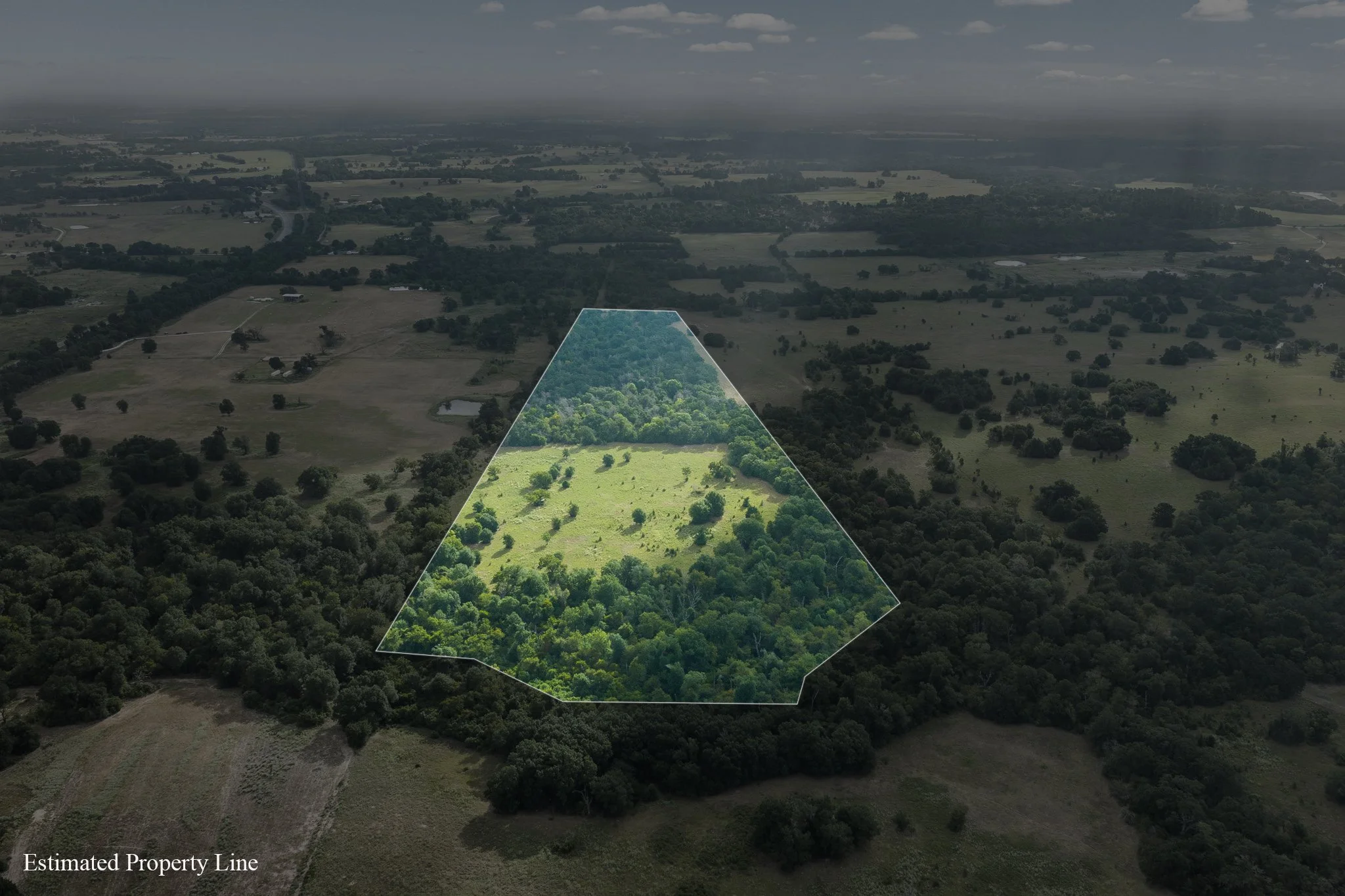
Yes. Boundary overlays can be added to select aerial imagery when included in the project scope. Property boundary information should come from the client or an appropriate survey source.
-
Yes. Photography, cinematic video, and aerial media can be booked together to create a more complete visual package for a listing or presentation.
-
Typical delivery is approximately 3–5 business days, depending on the scope of the shoot and requested deliverables.
Freebie alert
Unlock Our Exclusive Insights & Current Packages