Show the ground, access, and scale buyers need to see
Land and Ranch Drone Photography in Houston, TX
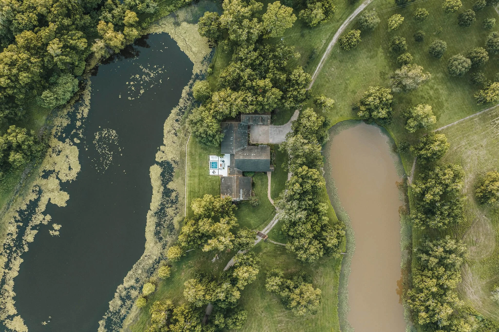
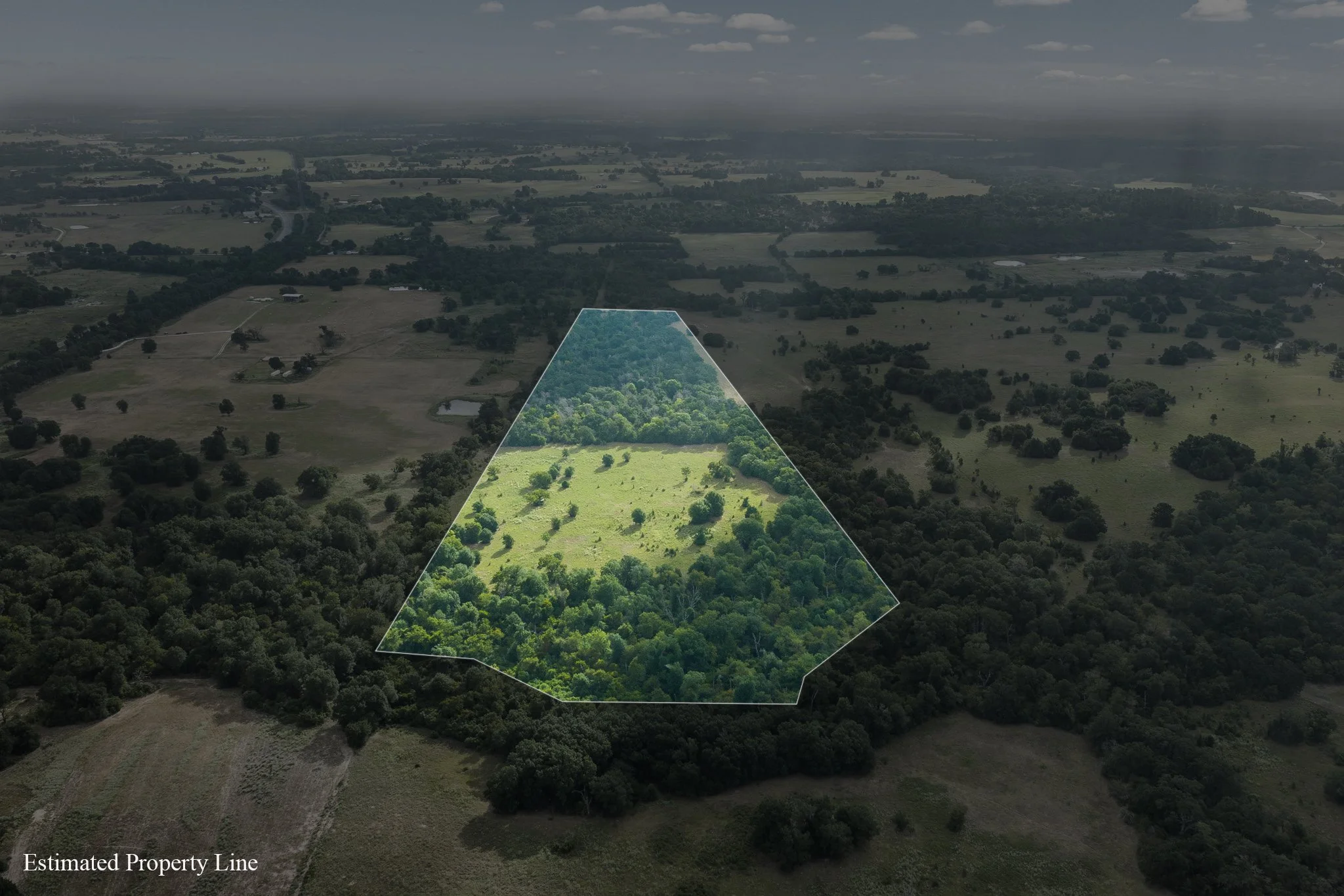
Land and ranch drone photography around Houston, TX gives prospective buyers a view beyond the gate. Skycrafted Imaging combines intentional aerial perspective with ground coverage so you can show acreage, approach, features, and setting in a way that is easier to understand.


Acreage loses its story when every image stays at ground level
A driveway image may capture a fence or stand of trees, but it rarely explains how an entrance, usable ground, water feature, improvement, and surrounding landscape relate to one another. For land and ranch buyers, orientation often matters before a long drive or a first visit.
When that context is absent, you are left explaining the most valuable features in captions and calls. Sellers may feel their property has been handled like an ordinary lot, and your marketing can feel smaller than the opportunity in front of you.
why skycrafted imaging
Land and ranch drone photography that makes Houston-area acreage easier to read

Skycrafted Imaging plans aerial and ground views around access, shape, features, and the property’s relationship to its surroundings. We create a considered visual story that helps qualified prospects arrive with a better understanding of what they are evaluating.
This is not random flight footage. It is purposeful drone photography and supporting coverage that respects the way land is viewed, compared, and discussed.
LAND AND RANCH DRONE PHOTOGRAPY SERVICES IN HOUSTON, TX
Choose the focused coverage that matches the assignment:

Your scope can include coverage that supports the listing:
High-resolution drone stills that establish acreage, tree cover, open ground, and surrounding context.
Ground photography of entrances, roads, improvements, water features, and key views.
Cinematic aerial video sequences and a property reel for listing promotion and social content.
Detail imagery that gives a ranch, recreational tract, or homesite a stronger sense of place.
Whether the property sits in Harris County or reaches into Fort Bend, Waller, or Montgomery County, we plan the visual story around the features you need buyers to see first.
the process
A clear plan from address to delivery
Step 1. Book your shoot
Share the address, acreage, and listing date. We confirm the scope, talk through the property’s priorities, and schedule the right window.
Step 2. We craft the story
A Part 107 pilot arrives prepared to capture aerial and ground coverage in one visit. We work with the property, light, access, and marketing goal in mind.
Step 3. Deliver in 3–5 days
You receive a curated, MLS-ready gallery and reel, licensed for your marketing. Clean delivery. Clear next steps. Assets ready to publish.

WHAT THEY’RE SAYING



The Team Behind Every Frame
Aerial coverage planned before takeoff
Founder Lane Fritsch leads Skycrafted Imaging, a Texas-based, licensed and insured operation. As an FAA Part 107 certified pilot, he brings professional aerial and ground gear together with a process that begins by understanding the land.
You work with one coordinated team, not a detached drone operator. That matters when the assignment needs the wide landscape and the on-the-ground character to tell the same clear story.

SCALE IS PART OF THE PROPERTY’S VALUE PROPOSITION
A ranch or land tract is evaluated as a connected whole: where it sits, how it is reached, what it offers, and how its features work together. Thoughtful media does not replace a survey or due diligence, but it gives prospective buyers a useful way to orient themselves.
Success: Buyers can see the setting and major features before they visit, creating a more informed starting point for showings and conversations.
Failure: Meaningful acreage becomes scattered snapshots, leaving access, scale, and the property’s strongest features invisible in the first scroll.
Give buyers a clearer reason to look closer
Your property is more than a lot line. Share its access, acreage, and timing, and we will help you plan media that presents its setting with the care it deserves
Practical answers before you book
-
Yes. Skycrafted works with properties ranging from smaller tracts to expansive Texas ranches and large land holdings. We determine the right combination of ground and aerial media based on the size and features of the property.
-
Yes. Boundary overlays can be added to select aerial imagery when included in the project scope. Property boundary information should come from the client or an appropriate survey source.
-
Yes. Photography, cinematic video, and aerial media can be booked together to create a more complete visual package for a listing or presentation.
-
Typical delivery is approximately 3–5 business days, depending on the scope of the shoot and requested deliverables.
Freebie alert
Unlock Our Exclusive Insights & Current Packages